
Islands and the bay · Smith Island
Smith Island, far out in the bay
No bridge reaches Smith Island. A small boat crosses open water to three villages of watermen, marsh and church steeples, where the layered cake is famous and the water keeps rising.
Smith Island sits out in the Chesapeake Bay, about a dozen miles west of Crisfield, at the southern end of Maryland's share of the bay. It is not one island but a cluster of low marsh islands cut by creeks and guts, with three small villages built on the few patches of slightly higher ground. No bridge connects it to the mainland, and no car ferry serves it. You arrive by boat, and you get around on foot, by bicycle or in a golf cart.
That isolation is the whole point and the whole difficulty. Smith Island has kept a way of life, a way of speaking and a set of traditions that have faded elsewhere on the bay. It has also lost land, people and businesses over the decades, and its future is a serious question. A day here is a chance to see a working watermen's community on its own terms, quietly and with respect.
The usual crossing is from Crisfield, the old seafood town at the southern tip of Somerset County. Passenger boats run from there to the island, and the trip across open water takes most of an hour depending on the boat and the weather. In the warm months there are also seasonal boats from points elsewhere on the bay.
The bay can be rough. A breezy day on land can mean a wet and bumpy ride on the water, and boats may not run in poor weather. If you are prone to seasickness, sit low and toward the middle of the boat. Bring a jacket even in summer, because the wind on open water is cooler than you expect.
Plan the drive to Crisfield carefully too. From Easton it is a long run south on the Eastern Shore, through Cambridge and past the marshes of Dorchester County. Many visitors combine it with a stop at Blackwater National Wildlife Refuge on the way down, or with the Harriet Tubman byway in Dorchester County.
Three villages
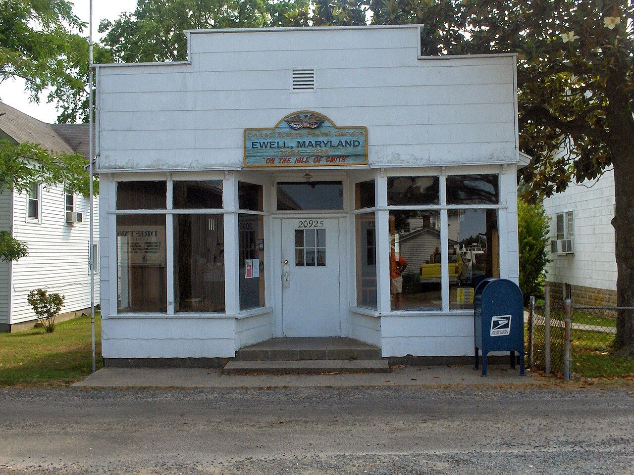
Ewell is the largest village and the one most boats reach first. It has the island's post office, a church, a few streets of white frame houses and the small heritage museum that tells the island's story through tools, photographs and recorded voices. A short road across the marsh leads to Rhodes Point, a quieter cluster of homes and boat sheds. The road is narrow and the views over the marsh on both sides are wide, which makes it a pleasant walk or ride.
Tylerton stands on its own island, separated from the others by water, and is reached only by boat. It is the smallest of the three and feels the most remote. Each village has its own Methodist church, and the churches remain at the heart of community life. The faith took hold here early in the nineteenth century and shaped the island's habits, holidays and sense of itself.
Walking around, keep in mind that this is home for the people who live here. Yards, docks and crab shanties are private. Ask before you photograph anyone, keep your voice down near the churches on Sunday, and leave the boats alone.
Also enteredOysters and the watermenWatermen, crabs and the speech of the island
Smith Island has always lived from the water. English settlers arrived in the seventeenth century, and their descendants turned to oystering, fishing and above all crabbing. The island is especially known for soft-shell crabs: watermen keep crabs in shallow floats and watch them closely, pulling each one out at the moment it sheds its hard shell. You will see the floats and shanties along the waterfront in the warm months. Our guide to Chesapeake blue crabs explains the season and the shedding trade.
The island's isolation also preserved its speech. Islanders speak with an accent and turns of phrase that sound unusual even to other Marylanders, and it is often described as keeping traces of the English that the first settlers brought from the West Country. Linguists have studied it closely, and younger islanders who move away tend to lose it. You will hear it simply by listening at the dock or the store counter.
The layered cake
Smith Island cake is the island's best-known export. It is a tall cake built from many thin layers, often eight or more, separated by a thin spread of icing, most traditionally chocolate fudge. The style is said to have grown from the custom of sending cakes out with the men during the oyster season, when a cake with thin layers kept well. Maryland named it the official state dessert in 2008.
Island bakers still make it, and slices are sometimes sold during the warm season. Bakeries on the mainland make it too, but eating a slice on the island, with the marsh outside, is part of the experience. If you see it offered, take the chance; supplies can be small.
Erosion and rising water
The most serious story on Smith Island is the land itself. The islands are low marsh, barely above high tide in many places, and the bay has been wearing them away for a long time. Sea level in the Chesapeake is rising, and parts of the region are also slowly sinking, so the effect on places like this is especially strong. Shorelines have retreated, marsh has turned to open water, and high tides now reach roads and yards more often.
The population has fallen too, as young people leave for work on the mainland and fewer families make a full living from the water. Jetties, stone revetments and marsh restoration projects have slowed the losses in some places. Much of the northern marsh is protected as Martin National Wildlife Refuge, which shelters herons, egrets, ospreys and wintering waterfowl, and the southern part of the island group reaches across the state line into Virginia.
The islanders who remain are proud and practical about their situation. Visiting, eating on the island and buying what is offered locally all help keep the place going. Go with time to spare, watch the weather and the boat schedule, and let the island set the pace. Our guide to the seasons on the bay can help you choose the right month for the crossing.